
Drain Mapping & Drainage Tracing Surveys
Find out where your drainage actually goes. We trace, map and level commercial drainage networks and turn them into reliable CAD drawings.
Call Us For A Free Quote 0345 548 5451- Surveyors based in Glasgow & Falkirk
- Graded defect reports & footage
- Drain mapping & CAD drawings
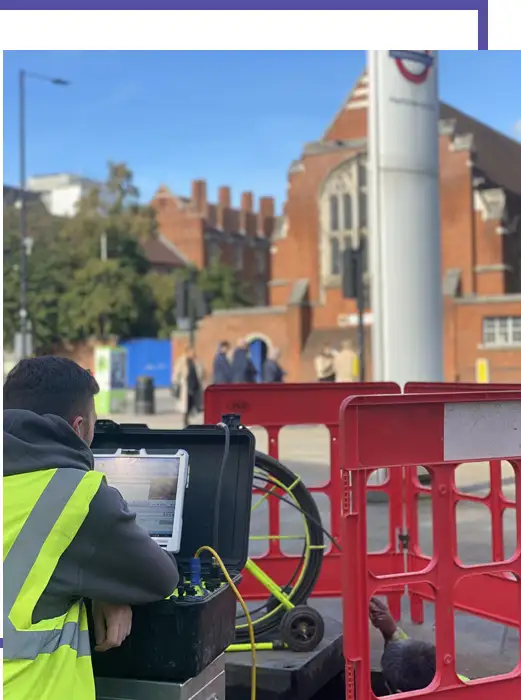
Drain mapping & tracing in Glasgow, Edinburgh & Central Scotland
Many commercial and industrial sites in Scotland have no reliable drainage drawing at all. Extensions, subdivisions, yard resurfacing and decades of repairs mean the plan in the O&M manual – if there is one – rarely matches what is underground. A drain mapping survey fixes that.
We open every accessible chamber, record what is in it, run the CCTV camera along each length and trace the route between chambers and to hidden connections. Positions and levels are surveyed so the result is a measured, scaled drawing rather than a sketch.
Find out more about our PAS128 utility surveys, GPR surveys, topographical surveys and drainage surveys across the UK on the main Ambler Group website.
Contact usHow we trace and map drainage
Mapping combines several techniques. Chambers are lifted and recorded with cover level, invert levels, depth, pipe sizes and connections. The CCTV camera confirms what connects to what and records condition along the way. Where runs pass between chambers that cannot be seen from the surface, the route is traced from the surface with locating equipment so the line can be marked out and surveyed.
Every feature is then picked up with GNSS or total station and drawn in CAD, with flow directions, pipe sizes, materials and levels annotated. Foul, surface water and combined systems are shown separately so it is clear what discharges where.
- Lifting and recording of every accessible chamber
- CCTV of connecting runs to confirm routes and connections
- Route tracing of runs that cannot be seen from the surface
- Survey-grade positions and levels for every feature
- Separate layers for foul, surface water and combined drainage
When commercial sites need a drain mapping survey
Facilities managers commission mapping so their teams and contractors stop guessing which gully drains where. Landlords and agents use it to create an estate drainage record. Contractors need it before extensions and new connections, and site operators need it to understand where foul and surface water discharge.
A good drain map also turns every future job into a quicker one: blockages are located faster, jetting crews know where to start, and repair quotes are based on fact.
Who uses this survey
- Facilities managers and estates teams
- Commercial landlords and managing agents
- Industrial and logistics site operators
- Contractors planning extensions or new connections
- Schools, campuses and public-sector estates
What you receive
- Scaled drainage plan in CAD and PDF
- Manhole schedule with cover levels, inverts, depths and connections
- Flow directions, pipe sizes and materials
- CCTV footage and condition notes for surveyed lengths
- Clear marking of unconfirmed or untraceable sections
How it works
- 1
Send us the site
Email a site plan or marked-up aerial with the areas and runs you need covering, plus access notes.
- 2
Fixed quote and RAMS
We confirm scope, days on site and any jetting, and issue site-specific RAMS for your induction.
- 3
Survey on site
Our surveyors attend from our Glasgow and Falkirk bases, set out traffic management where needed and survey the network.
- 4
Report and drawings
You receive the report, footage and drawings in formats your team or client can use straight away.
Drain mapping & tracing across Central Scotland
Our surveyors are based in Glasgow and Falkirk. Choose your area for local information.
Drainage surveys in Glasgow
Commercial and contractor drainage surveys across Glasgow city and the surrounding estates, delivered by surveyors based in Glasgow.
View areaDrainage surveys in Edinburgh
Commercial drainage surveys for Edinburgh offices, retail, hospitality, estates and construction sites – with an Edinburgh address and surveyors close by in Falkirk.
View areaDrainage surveys in Falkirk & Grangemouth
Industrial and commercial drainage surveys across Falkirk district, from surveyors based in Falkirk itself.
View areaDrainage surveys in Cumbernauld
Commercial, industrial and construction drainage surveys across Cumbernauld, Kilsyth and the M80 corridor – 20 minutes from our Falkirk and Glasgow surveyors.
View areaDrainage surveys in Stirling
Commercial, public-sector and construction drainage surveys across Stirling and Clackmannanshire, minutes from our Falkirk base.
View areaDrainage surveys in Perth
Commercial, industrial and construction drainage surveys across Perth and Perth & Kinross, reached quickly from our Falkirk base via the M9 and A9.
View areaDrain mapping & tracing in Central Scotland | Frequently Asked Questions
Q1: What is the difference between a drain mapping survey and a CCTV survey?
A: A CCTV survey records the condition of the pipes. Drain mapping records where the pipes are, how deep they are and how they connect, and produces a measured drawing. Most commercial clients need both, and we normally deliver them together.
Q2: Can you map drainage where there are no existing plans?
A: Yes. That is one of the most common reasons we are instructed. We build the drawing from scratch from what we find on site.
Q3: How accurate is the drawing?
A: Chambers and surface features are surveyed with survey-grade GNSS or total station. Pipe routes between chambers are drawn from CCTV distances and surface tracing, and any section we could not confirm is clearly marked.
Q4: Can the drain map be combined with other services?
A: Yes. We can include buried utilities from a PAS128 survey and site features from a topographical survey on the same drawing.
Need a service & ready to book? Call us 0345 548 5451
Email usWhy choose Ambler Group for your drainage surveys in Central Scotland?
Surveyors based in Scotland
Our surveyors work from Glasgow and Falkirk, so your site in Central Scotland gets a local Scottish team who know the area – not a crew driving up from England.
Surveyors, not drain clearers
We survey and report rather than sell repairs, so our findings and recommendations are independent and written for FMs, landlords, designers and contractors.
Everything in one visit
CCTV drainage, PAS128 utility, GPR and topographical surveys from one team, with one set of RAMS and one coordinated set of drawings.
If you’re looking for reliable, professional CCTV drainage surveys in Central Scotland, contact us today!
Related drainage surveys
Pre-construction drainage surveys
Existing drainage traced, surveyed and drawn before design is fixed or ground is broken.
Find out moreDrainage condition surveys (FM & PPM)
Planned condition surveys that turn drainage into a budgeted, prioritised maintenance plan.
Find out moreDrainage defect & flooding investigations
Finding the cause of repeat blockages, flooding, odours and misconnections.
Find out moreGuides for this survey
What Does a Commercial CCTV Drainage Survey Cost?
The factors that set the price of a commercial drainage survey, and what to send for a fast, fixed quote.
Read the guide GuideDrainage Surveys Before Construction: A Checklist for Contractors
What to survey, what to ask for and when, so existing drainage doesn’t surprise you mid-programme.
Read the guide GuideCCTV Drainage Survey, Drain Mapping or Utility Survey: Which Do You Need?
What each survey tells you, when you need it, and when to combine them.
Read the guide GuideYard Flooding on Commercial Sites: Causes and How to Find Them
The usual causes of standing water on yards, car parks and loading bays, and how a survey pins them down.
Read the guideOther surveys we provide in Central Scotland
Ambler Group is a full surveying company. Book your drainage survey alongside any of these and get one team, one set of RAMS and one coordinated set of drawings.
PAS128 Utility Surveys
Locating and mapping buried services – water, gas, electric, telecoms, drainage – to PAS128 quality levels before you dig.
Find out moreGPR Surveys
Ground-penetrating radar for non-metallic services, voids, and concrete scanning (ferroscanning) of slabs and structures.
Find out moreTopographical Surveys
Measured site surveys of levels, features and boundaries in CAD, ready for design, planning and setting out.
Find out moreDesktop Utility Searches
Statutory record (STATs) searches from asset owners, compiled into a single pack before site works or design.
Find out moreBorehole Clearance
Service clearance of borehole and trial pit positions for site investigation contractors.
Find out moreDrainage Surveys (UK-wide)
Our main drainage survey service page, covering CCTV drainage surveys and drain mapping across the UK.
Find out moreClients Reviews
“I contacted Ambler group for help and advice and they found me the perfect solution saving me money. Such a friendly and professional team I’d highly recommend them to anyone needing to locate underground services.”
Ambler Group client – CCTV and utility survey
Contact Us
Book a drainage survey
For a fast, fixed quote, send us:
- The site address or postcode
- A site plan or marked-up aerial image showing the areas to survey
- What the survey is for – purchase, design, handover, maintenance or a defect
- Access notes – working hours, permits, inductions
We usually come back with a fixed quote the same or next working day.
Locations:
5 South Charlotte Street,
Edinburgh EH2 4ANAmbler Group Limited
Springfield House, Springfield Road,
Horsham RH12 2RGCompany registration number: 12568344
Surveyors based in:
Glasgow and Falkirk, covering Glasgow, Edinburgh, Falkirk, Cumbernauld, Stirling, Perth and the rest of Central Scotland.